Site hosted by Angelfire.com: Build your free website today!
Travlin' In Georgia, Georgia, Grist Mill, Covered Bridge, Barn, Waterfall, Janie Oliver, Atlanta, Ellijay, Rabun Gap, Dillard, Matha Berry College, Sells Mill Park, Hurricane Shoals, Mocassin Creek State Park, Georgia State Park, Stone Mountain Georgia, Kennesaw, Georgia, Varnell, Georgia, High Falls State Park, Marietta, Georgia, Sixies Mill, Auchumpkee Covered Bridge, Georgia State Veteran State Park, Big Spring Park, Georgia, Dedartown, Georgia, Lindale Grist Mill, Lindale, Georgia, Marietta National Cemetery, Elder Mill Covered Bridge, Concord Covered Bridge, Prater's Mill, Rex Mill, Rex, Georgia, Alcovey Road Grist Mill, Starrs Mill, Starrs, Georgia, Big Red Oak Creek Covered Bridge, Poole's Mill Covered Bridge, Bear Creek Falls, Georgia, Cordele, Georgia, Roswell, Georgia, Acworth, Georgia, Euharlee Covered Bridge, Euharlee, Georgia, Shoulderbone Junction, Georgia

EVERYONE NEEDS A GARMIN

In November 2008 while visiting my son, Robert Lique and I met for dinner in Kennesaw. Robert lives about an hour above Kennesaw in Ellijay and it’s a simple trip down Highway 575 to Kennesaw. Robert invited me to visit him enticing me with all the beauty in the mountains of North Georgia. It was September 2009 before I made it up to see Robert.

If you travel much I highly recommend you buy a Garmin. I purchased my first Garmin in the summer of 2008 and that Garmin only failed me twice. The first failure I experienced with my Garmin was when Robert and I decided to follow the directions it gave us to find a waterfall.

We took off early in the morning on our first trip to explore Georgia but decided to rummage around the area surrounding Ellijay first. Our next destination was to a waterfall that we had determined via computer was very close to Robert’s house.

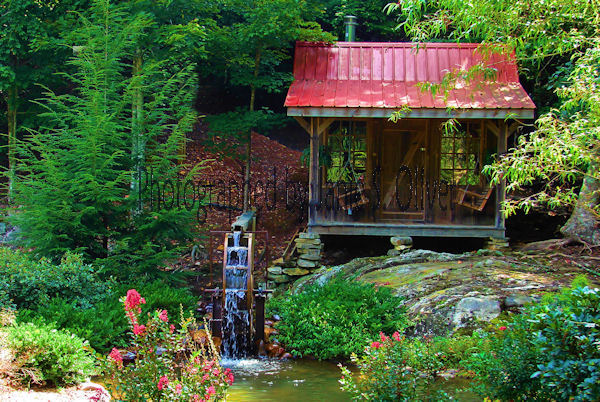
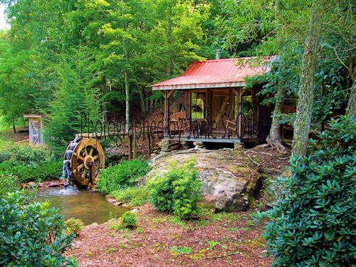
Our first find was this small mill right before we went up the mountain at Double Eagle Preserve. I couldn't stop taking pictures of this little mill.


Then we continued on up the mountain.


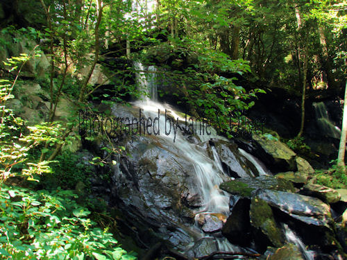
After we came down from the Double Eagle Preserve (and took a few more pictures of the mill--at my request) is when the fun really began. Robert had attempted to find the waterfall we were heading for before but had been unable to do so. Waterfalls do not have street addresses because they don’t have house numbers. But, Robert had searched the Internet and printed off the directions to the waterfall. Unforunately the computer directions left off one road that Robert would have recognized. These instructions did include the coordinates. So we put the coordinates into my Garmin and off we went into the Cohutta Wilderness. The Cohutta Wilderness was designated in 1975, expanded in 1986, and currently consists of 36,977 acres and approimately 35,268 of these acres are located in Georgia in the Chattahoochee National Forest. The other acreage is in Tennessee. After this trip it is a wonder that Robert and I ever went on another one day trip exploring Georgia.


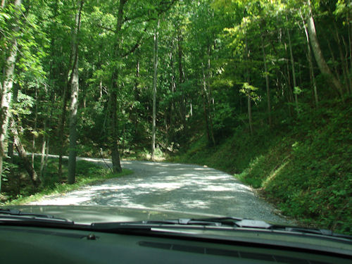
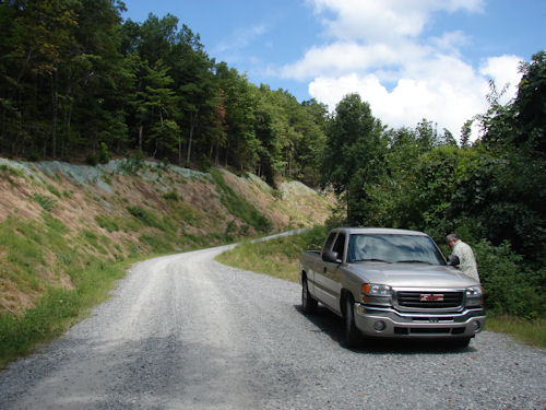
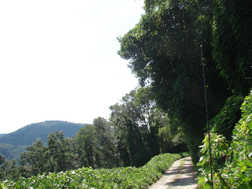
Photo on left is the view from inside Robert’s truck of the road that the Garmin directed us to travel on. Up the mountain we went on this narrow dirt road.

Photo on right is another picture from inside the truck of the road we were traveling on. Robert kept saying, “I hope we don’t meet anyone.” I kept saying, “Robert don’t get to close to the edge." Honestly on this road there were places on the side of the road that was a straight drop off the mountain.


Occasionally there were pull overs. That’s Robert getting back in the truck. I was running around taking pictures of flowers on the side of the road. We had also seen some gorgeous mountain views. But the best views were yet to come.

At the top of the mountain we found a surprise. The water fall? No. An old graveyard with it's own open air church and some very old graves.


The above picture is me in the graveyard with the open air church behind me.


In the upper right hand corner of this picture you will see the road that took us to the top of this mountain. Can you tell this road on which we traveled impressed me? Despite the fact that we dreaded meeting people on this road—meet other vehicles we did. We weren’t the only ones that were exploring that mountain. I wondered how many of them were using a Garmin. Somehow we managed to pass each other on that narrow road and I still have flash backs to us passing other vehicles. In psychology we call that PTSD.

After the graveyard we began to travel down the mountain and at the bottom we found of all things a restroom in a state camping park. Here there were people riding horses because there were horse stables nearby on the mountain.

We thought we were home free! We were off the mountain! But, then we started to climb again. My Garmin was taking us over two mountains!!! And climb we did. This is, however, where we saw the best mountain views.

CLICK HERE FOR MOUNTAIN VIEW

After traveling two mountains, four hours, and over one hundred miles this is what we found.

CLICK HERE FOR WHAT WE FOUND

And although my Garmin didn't give us the shortest route to the waterfall, I can't say that it really failed us. My Garmin took us on an enjoyable, beautiful, and adventurous trip. We do now know that the waterfall is about fifteen minutes from Robert's house and have made the trip again since the first time. After the waterfall we continued on down to the bottom of the mountain where we both recognized the road. We had been there that morning and if my Garmin had taken us in the opposite direction we would have seen the waterfall within about ten minutes.


BEAR CREEK FALLS


And as this story ends we leave you with an Ellijay mountain sunset.


Janie S. Oliver


All rights to these photographs are reserve. Please do not download or copy any of these photographs without my written permission.


Email me at jso9424@bellsouth.net


How It All Began


Everyone Needs a Garmin


North Georgia in Cold Weather


A Journey of Conviction